ISRO NVS-03 Launch October 30: India's NavIC Comeback Satellite
India’s long wait for a fully working home-grown navigation system reaches a decisive moment this week. The Indian Space Research Organisation is targeting Friday, October 30, 2026, to launch the NVS-03 navigation satellite aboard a Geosynchronous Satellite Launch Vehicle Mark II from the Satish Dhawan Space Centre at Sriharikota, in a mission that could finally restore the Navigation with Indian Constellation, better known as NavIC, to full standalone service.
The launch is scheduled for 11:51 p.m. Indian Standard Time, according to multiple Indian media reports published on October 26, and public registration for launch viewing has already opened. The mission, designated GSLV-F18, will carry the 2,232-kilogram spacecraft first into a geosynchronous transfer orbit, from where its own propulsion system will raise it to a permanent geosynchronous slot at approximately 32.5 degrees East.
For ISRO, this is far more than a routine satellite launch. NavIC has been operating below the minimum threshold for independent three-dimensional positioning, with only three satellites reported functional. NVS-03 is designed to become the fourth, the magic number that lets a navigation constellation compute a standalone position fix without leaning on foreign systems. If the launch and the subsequent orbit-raising succeed, India will once again be able to offer its citizens, its armed forces, and its disaster-response agencies a positioning service that answers to no one else.

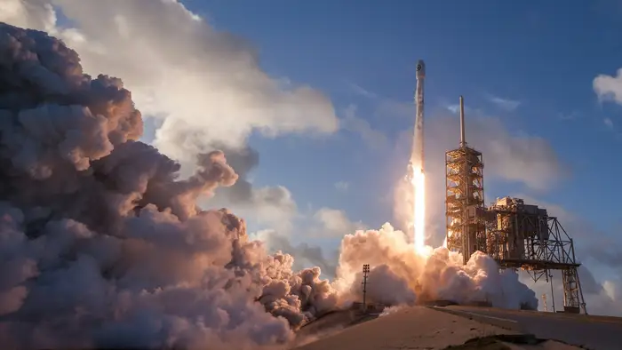
A rocket climbs away from its launch pad into the night sky. Image: Unsplash.
A launch years in the making
NVS-03 has been a long time coming. The satellite was delivered to the Satish Dhawan Space Centre and declared ready for launch as of August 14, 2026, and its launch campaign formally began on September 14, with stacking of the rocket’s first stage completed by September 21. An earlier tentative window running from October 15 to 20 slipped, and the October 30 date was attributed to ISRO chairman V. Narayanan in an Indian Express report on October 22. United News of India separately reported on October 24 that preparations at Sriharikota were under way for the October 30 attempt.
The delays are part of a longer story. NVS-03 is the third spacecraft in the second-generation NVS series, numbered NVS-01 through NVS-05, and the twelfth satellite overall in the Indian Regional Navigation Satellite System family, where it also carries the designation IRNSS-1L. Its predecessors have had mixed fortunes. NVS-01 launched successfully in May 2023 and remains in service. NVS-02, by contrast, suffered propulsion problems after launch and never entered navigation service, a failure that left the constellation short-handed and pushed the schedule for its replacement back by years.
That history matters because NavIC’s troubles did not begin with NVS-02. The first-generation constellation was plagued by failures of its rubidium atomic clocks, the exquisitely precise timekeepers at the heart of any satellite navigation system, and by the loss of the IRNSS-1H satellite in a launch failure. By early 2026, parliamentary replies and press reporting indicated that only three positioning satellites remained operational: IRNSS-1B, IRNSS-1I, and NVS-01. A navigation constellation needs at least four satellites in view to solve for latitude, longitude, altitude, and receiver clock error. With three, NavIC could not stand on its own.
NVS-03 is built to close that gap. Once commissioned, it will join the three functioning satellites to meet the four-satellite minimum for standalone positioning, navigation, and timing services, restoring a capability India has been without for an extended stretch.
What NVS-03 carries
The spacecraft is built on ISRO’s I-2K satellite bus by the U. R. Rao Satellite Centre in Bengaluru, with navigation payloads from the Space Applications Centre in Ahmedabad. It weighs 2,232 kilograms at launch and is designed for a 12-year operational life in geosynchronous orbit, a long tenure that reflects how much ISRO is counting on this single satellite.
Its most important payload is also its most symbolic: an indigenous rubidium atomic clock developed by the Space Applications Centre. Earlier NavIC satellites relied on imported atomic clocks, and when those units failed, the constellation paid the price. Building the timekeeper at home is both a technical fix and a statement of self-reliance, removing a dependency that once threatened the entire system.
NVS-03 will broadcast navigation signals in the L1, L5, and S bands, supplemented by a C-band ranging payload. The L1 civilian signal is the headline addition of the second-generation series. Older NavIC satellites broadcast in L5 and S bands, which limited compatibility with mass-market receivers. L1 is the band used by the world’s major navigation systems, and adding it is intended to make NavIC signals accessible to ordinary smartphones and consumer devices, opening the system to a far larger user base than the specialised receivers it has served until now.
That consumer angle is central to ISRO’s pitch for the second generation. NavIC’s primary service area covers India and a region extending about 1,500 kilometres beyond the country’s landmass, a footprint that takes in much of South Asia and the northern Indian Ocean. Within that area, the system offers a standard positioning service for civilian users and a restricted, encrypted service for authorised users, including the armed forces and strategic agencies. Fishermen in the Bay of Bengal, truck drivers on Himalayan highways, and survey teams in remote districts all stand to benefit from a signal that does not depend on a foreign constellation.
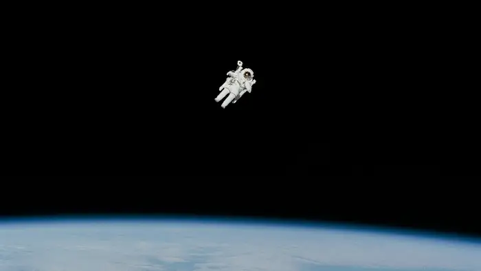
A view of Earth from orbit, where navigation satellites keep watch over the planet below. Image: Unsplash.
Why India built its own GPS
NavIC was conceived in the aftermath of the 1999 Kargil conflict, when India found that access to foreign military navigation signals could not be taken for granted in a crisis. The lesson was blunt: a country that cannot locate itself on its own terms is strategically exposed. The system was therefore designed from the start as a sovereign capability, a seven-satellite regional constellation of three geostationary satellites and four inclined geosynchronous satellites, sized to cover India and its neighbourhood rather than the whole globe.
That regional focus is a deliberate trade-off. Global systems such as the United States’ GPS, Russia’s GLONASS, Europe’s Galileo, and China’s BeiDou use dozens of satellites in medium Earth orbit to cover the planet. NavIC uses far fewer spacecraft parked much higher, in geosynchronous orbit, where each satellite lingers over the same broad region. The geometry gives strong coverage over India with a smaller fleet, at the cost of a service area that ends roughly 1,500 kilometres beyond the border.
The strategic logic has only sharpened with time. Defence agencies need positioning and timing they can trust in a conflict. Maritime operators need it across the Indian Ocean. Disaster management teams need it when cyclones knock out terrestrial infrastructure. And a growing civilian economy, from precision agriculture to app-based logistics, needs timing signals accurate to billionths of a second. All of those users currently lean heavily on foreign constellations. NavIC is India’s answer to that dependence, and NVS-03 is the satellite that determines whether the answer is credible.
The stakes are visible in the wider satellite-launch landscape. Constellation building has become one of the defining races in modern spaceflight, whether it is a military mesh network like the one described in Pentagon’s Orbital Mesh Grows: 21 Northrop Grumman Satellites Join SDA Tranche 1, a commercial direct-to-cell fleet such as the one covered in Three More BlueBirds Take Wing: SpaceX Lofts AST SpaceMobile’s Direct-to-Cell Trio as Booster B1077 Hits 30 Flights, or a national Earth-observation fleet like the one in South Korea’s Nuri Rocket Flies Its Biggest Mission Yet: 15 Satellites for a New Earth-Watching Constellation. What sets NavIC apart is that its purpose is not broadband or imagery but the invisible infrastructure of position and time itself.
The flight plan
The GSLV Mk II is a workhorse of the Indian programme, a three-stage vehicle with a cryogenic upper stage that has carried many of ISRO’s heaviest communications and navigation payloads to geosynchronous transfer orbit. GSLV-F18 will follow the familiar profile: liftoff from Sriharikota’s second launch pad, ascent through the atmosphere, and separation of the spacecraft into an elliptical transfer orbit.
What follows is a slower, quieter phase that is just as critical. Over the days after launch, NVS-03’s onboard liquid apogee motor will fire in a series of burns to circularise the orbit at geosynchronous altitude, roughly 36,000 kilometres above the equator, and drift the satellite to its assigned slot near 32.5 degrees East. Engineers will then deploy its solar panels and antennas, switch on the navigation payloads, and begin a period of in-orbit testing before the satellite is declared operational and handed over to the NavIC ground segment.
Only at that point, weeks after the roar of liftoff has faded, will the mission’s real test be answered: whether the indigenous atomic clocks keep time, whether the L1 signal reaches consumer-grade receivers, and whether the constellation once again delivers a standalone fix. Launch success and mission success are different milestones, and ISRO’s engineers will be watching both.
An illustration-style view of a communications satellite in orbit above Earth. Image: Unsplash.
What comes after NVS-03
ISRO is not treating NVS-03 as the end of the story. The Press Information Bureau noted in August 2026 that NVS-04 and NVS-05 are already under advanced realisation, meaning the second-generation series will continue to grow after this launch. Each additional satellite adds redundancy, improves geometry, and strengthens the signal over the service area. A constellation that has lived for years on the edge of viability needs depth, not just a single replacement, and the pipeline suggests ISRO understands that.
The launch also sits inside a busy period for the Indian programme. Chairman Narayanan has said ISRO plans to conduct the first uncrewed test flight of the Gaganyaan human spaceflight programme within the next two months, followed by two further uncrewed tests before any crewed mission, evaluating environmental control, safety systems, crew escape mechanisms, and module interiors. The agency has carried out roughly 8,000 ground-based experiments for Gaganyaan, and four astronaut-designates are in specialised training. Looking further ahead, Narayanan outlined plans for Chandrayaan-5, a collaborative lunar mission with Japan featuring a 350-kilogram rover designed for 100 days of surface experiments.
That breadth matters for how NVS-03 should be read. It is not a one-off prestige launch but one element of a programme that is simultaneously rebuilding its navigation backbone, preparing to fly humans, and planning a return to the Moon. Success on October 30 would give all three strands a lift; a failure would force hard questions about a constellation that has already consumed years of recovery effort.
There is also a commercial dimension that rarely makes headlines. A navigation signal that works in ordinary phones is a platform. If the L1 signal performs as intended, Indian handset makers and app developers could build NavIC support into devices sold across South Asia, and neighbouring countries inside the service footprint could adopt the system for their own civilian use. That is how a regional system earns relevance beyond its borders: not by decree, but by being useful in the device already in a user’s pocket.
How NavIC stacks up against the world’s navigation giants
To understand why a single satellite matters so much, it helps to place NavIC beside the systems it is measured against. The United States’ Global Positioning System operates a constellation of more than 30 satellites in medium Earth orbit, roughly 20,000 kilometres up, circling the planet twice a day. Russia’s GLONASS, Europe’s Galileo, and China’s BeiDou follow a similar global blueprint, each fielding two dozen or more spacecraft to guarantee that at least four are visible from any point on Earth at any moment. Their signals are so embedded in modern life that most people never think about them: every smartphone, every airliner, every container ship and every power grid leans on them.
NavIC takes a different path. Its seven planned satellites sit in geosynchronous orbit, about 36,000 kilometres above the equator, where they appear almost fixed over the same region of sky. Three of them are truly geostationary, hovering over fixed longitudes, while four follow inclined geosynchronous paths that trace a figure of eight over the service area each day. The geometry means that over India, NavIC satellites appear higher in the sky than GPS satellites often do, which can help signals reach into urban canyons and mountain valleys where a low-angle signal might be blocked. The trade-off is coverage: step outside India and its 1,500-kilometre buffer zone, and the constellation thins out fast.
Accuracy is the other comparison users care about. ISRO has long stated that NavIC is designed to deliver positioning accuracy better than 20 metres for civilian users across its primary service area, with the restricted service offering considerably tighter performance for authorised users. In practice, modern receivers combine signals from several constellations at once, so a phone in New Delhi typically listens to GPS, Galileo, and BeiDou simultaneously and blends the results. NavIC’s value in that mix is redundancy and sovereignty: when other signals are degraded, jammed, or simply switched off for a region, an Indian receiver with NavIC support still has an independent source of position and time.
That jamming and spoofing threat is no longer theoretical. Military forces have repeatedly encountered GPS interference in recent conflicts, and civilian aviation authorities have issued warnings about spoofed navigation signals in several regions. A second, independent constellation does not make interference disappear, but it raises the cost and complexity for anyone trying to deny navigation to an entire area. For a country with contested borders and a long coastline, that resilience argument carries as much weight as any civilian benefit.
There is also a quiet economic logic. Every timing signal that synchronises a telecom network, timestamps a stock-market trade, or guides a tractor through a field currently traces back to a foreign constellation. Building a domestic alternative does not replace those systems overnight, but it gives India a seat at the table where the rules of satellite navigation are written, and a fallback if the table ever gets upended. NVS-03, with its L1 signal tuned for consumer receivers, is the first NavIC satellite designed to make that argument in the mass market rather than only in government briefing rooms.
The view from Sriharikota
For the teams at the Satish Dhawan Space Centre, the final days before launch follow a well-worn rhythm: rehearsals, fuel checks, weather briefings, and the quiet tension of a countdown that has already slipped once. The October 15 to 20 window came and went without a launch, and the revised October 30 date gives engineers a clean run at the target. Public registration for viewing suggests confidence that the date will hold, though as with every launch, the usual caveats apply: technical or weather considerations can move a liftoff at short notice.
The timing of the launch, late on a Friday night in India, means much of the country will be asleep when the GSLV climbs into the dark. But the audience that matters most will be awake: the flight dynamics teams tracking the ascent, the ground stations waiting for the first signal from the transfer orbit, and the navigation engineers who have spent years explaining why four satellites matter more than three. For them, the night of October 30 is the night NavIC either comes back or stays waiting.
India’s navigation story has always been about independence. The Kargil lesson of 1999 was that a borrowed signal can be withdrawn at the worst possible moment. The atomic-clock failures of the 2010s taught a second lesson, that even a home-grown system is only as strong as its weakest component. NVS-03 carries both lessons in its design: an Indian clock, a civilian signal, and a slot in the sky that will either restore the constellation’s independence or leave it one satellite short once again.
When the GSLV-F18 lifts off from Sriharikota on October 30, it will carry more than 2,232 kilograms of hardware. It will carry the answer to a question India has been asking for a quarter of a century: can this country find its own way, on its own signal, when it matters most?

Stars over a dark landscape, a reminder of the navigation constellations overhead. Image: Unsplash.
Earth’s horizon glowing against the darkness of space. Image: Unsplash.